


Abu Dhabi is strategically adapting its urban infrastructure to accommodate the rising demand for micromobility, such as bike-sharing and electric scooters, leveraging advanced digital simulation tools to reshape its transport landscape, according to Marios Ntaflos, Product Sales Engineer, Mobility Simulation for Bentley Systems.
In an exclusive interview with Gulf Construction, Ntaflos highlights the crucial role of Abu Dhabi's 3D transport model, STEAM (Strategic Transportation Evaluation and Assessment Model), which is instrumental in simulating and evaluating infrastructure projects and transport policies, enabling authorities to proactively plan for evolving resident preferences, particularly for short-distance travel.
Abu Dhabi Mobility (ADM), the emirate's transport department, is making significant investments in infrastructure development and new policies to support micromobility. As part of this effort, ADM has partnered with CitiME, a Bentley Systems channel partner specialising in mobility software solutions.
One of the primary challenges identified in integrating "soft transport" modes like bikes and scooters was the scarcity of detailed data on short trips, which often occur within or between small zones. Ntaflos explains that the existing model, designed around large strategic transport zones, was insufficient to capture the nuanced movement patterns of pedestrians, cyclists, or scooter users. To overcome this, the STEAM model was adapted with advanced simulation tools, allowing for more accurate digital testing of new infrastructure and policies.
 |
|
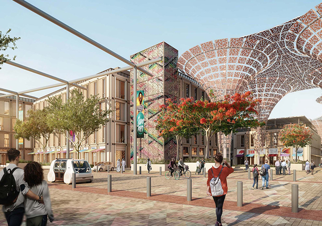
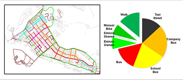
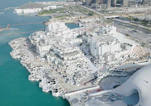
ADM is integrating soft modes of transportation into its strategic STEAM model. |
CitiME's expertise, particularly in the Middle East, proved vital in upgrading ADM's original CUBE modelling software to support these new sustainable soft transport modes for shorter journeys.
Addressing infrastructure gaps, such as bike lanes and scooter parking zones, especially in high-density areas, involves digitally simulating the impact of proposed changes. ADM is integrating soft modes of transportation into its strategic STEAM model to digitally evaluate and test various transport scenarios. The team utilises OpenPaths CUBE to simulate, visualise, and assess how infrastructure modifications will affect local movement and accessibility for bikes, scooters, and pedestrians. This includes detailed network elements like pavements, cycle tracks, and park pathways, significantly expanding the infrastructure map for accurate planning.
 |
|
Ntaflos: “One of the primary challenges in incorporating soft modes of transport into Abu Dhabi’s urban layout was the lack of detailed data on short trips”. |
Ntaflos underscores the key benefits of OpenPaths CUBE over traditional urban planning tools, noting its ability to transition from large-scale transport models to localised simulations that encompass short trips and soft transport modes. The model's detail and scope have expanded from 150,000 to over a million links, allowing for the incorporation of features like zebra crossings and bike paths into transport analysis. The platform also supports complex zoning disaggregation using detailed, building-level data. This precision enables urban planners to test various mobility scenarios with unprecedented accuracy, leading to smarter, data-driven decisions for sustainable short-distance travel.
Technology, Ntaflos states, is bridging the gap between data collection and on-ground infrastructure implementation. By integrating detailed infrastructure features and highly localised data into Abu Dhabi's transport model, planners can simulate the real-world impact of changes before physical alterations are made. This digital-first approach, guided by algorithms predicting route choices based on behaviour, ensures that new developments align with actual mobility patterns and broader urban goals.
Excerpts of the interview with Marios Ntaflos:
How is Abu Dhabi’s current urban infrastructure adapting to the growing demand for micromobility?
Abu Dhabi is actively reshaping its urban mobility landscape to support the rise of micromobility, such as bike sharing and electric scooters. A key step has been the development of its 3D transport model called STEAM (Strategic Transportation Evaluation and Assessment Model), which is used to simulate and evaluate infrastructure projects and transport policies. This approach allows authorities to strategically plan and implement infrastructure that accommodates the evolving preferences of residents, particularly for short-distance travel.
Abu Dhabi’s transport department, Abu Dhabi Mobility (ADM), is investing in developing appropriate infrastructure and new policies to promote and support their use. As part of this investment, it has retained CitiME, a Bentley Systems channel partner offering mobility software solutions.
Through digital assessments of localised travel patterns, authorities are now better equipped to test and refine policies and infrastructure specific to micromobility. This includes modelling short trips that traditional transport analyses might overlook, enabling smarter decisions to promote sustainable urban travel.
 |
|
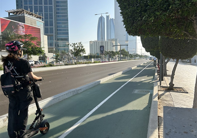
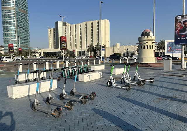
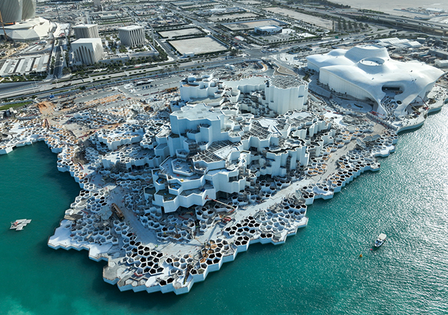
Infrastructure gaps for micromobility, such as bike lanes, scooter paths, and pedestrian crossings, are being addressed by digitally simulating how changes would impact mobility in high-density areas |
Were any key planning challenges identified when incorporating soft transport (bikes, scooters) into the city’s existing layout?
One of the primary challenges in incorporating soft modes of transport into Abu Dhabi’s urban layout was the lack of detailed data on short trips, which typically fall within or between small zones. The existing model, built around large strategic transport zones, was not enough to capture the movement patterns of pedestrians, cyclists, or scooter users. Using the integrated model allows ADM to test infrastructure changes like bike lanes before implementation, supporting sustainable and efficient urban mobility.
To address this, experts worked to adapt the STEAM model with advanced simulation tools, allowing for more accurate digital testing of new infrastructure and policies. This upgrade involved redesigning the model to better reflect localised travel behaviours, providing the insights needed to plan infrastructure tailored to micromobility in a dense urban environment.
With extensive experience in projects across the Middle East, CitiME understands the unique challenges of urban mobility and micromobility in these diverse environments. The multimodal transport planning software addressed the need to install a new version of ADM’s original CUBE modelling software to adapt the strategic model to support these new sustainable soft transport modes for shorter journeys.
 |
|
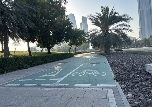
The modelling includes detailed network elements like pavements and cycle tracks. |
How are you addressing infrastructure gaps, such as bike lanes or scooter parking zones, especially in high-density areas?
Infrastructure gaps for micromobility, such as bike lanes, scooter paths, and pedestrian crossings, are being addressed by digitally simulating how changes would impact mobility in high-density areas. As I mentioned previously, ADM is adapting its strategic STEAM model, integrating soft modes of transportation to digitally evaluate and test different transport scenarios and determine the best infrastructure solutions to accommodate micromobility. The team uses Bentley OpenPaths CUBE to simulate, visualise, and evaluate how changing the infrastructure will impact local movement and accessibility to provide better local network systems for bikes, scooters, and pedestrians.
The modelling includes detailed network elements like pavements, cycle tracks, and park pathways, greatly expanding the infrastructure map to support accurate planning.
CitiME used OpenPaths CUBE to update the STEAM strategic model, incorporating the coding of soft mode-specific infrastructure, such as zebra crossings, pavements, cycle tracks, and park paths, into the network. This enhanced model now supports over a million links, including all possible links that can be used for short trips, enabling planners to assess local movement patterns more comprehensively.
By refining how people choose routes based on their transport mode, planners can better visualise the effectiveness of proposed changes before they are physically implemented, ensuring a more sustainable and user-friendly urban design.
They also created a new set of guidelines that specify how individuals who use cars and other soft transportation methods decide the routes to take between their starting point and their final destination. By combining these algorithms, they modified the strategic model to include localised travel.
What are the key benefits of using OpenPaths CUBE over traditional urban planning tools?
The use of OpenPaths CUBE has enabled a significant leap from traditional, large-scale transport models to localised simulations that consider short trips and soft transport modes. By increasing the detail and scope of the model, from 150,000 to over a million links, it is now possible to incorporate infrastructure like zebra crossings and bike paths into transport analysis.
Additionally, the platform supports complex zoning disaggregation using disaggregated data, such as utilities at the building level. They created a new set of rules that define how people using both cars and soft transport modes choose their routes between the origin and destination of their trip, integrating these algorithms to adapt the strategic model to address localised trips.
All of this means urban planners can test various mobility scenarios with a level of precision not previously possible, ultimately supporting smarter, data-driven decisions for short-distance, sustainable travel options.
How is technology bridging the gap between data collection and on-ground infrastructure implementation?
Technology plays a critical role in transforming raw data into actionable urban planning insights. By integrating detailed infrastructure features and highly localised data into Abu Dhabi’s transport model, planners can now simulate how changes will influence real-world movement before making alterations.
The model incorporates both traditional and soft transport modes, guided by algorithms that predict route choices based on behaviour. This digital-first approach enables thorough assessments of infrastructure needs and performance, ensuring that new developments align with actual mobility patterns and urban goals.


.jpg)